
Get Your Free NDVI Scan
Whats NDVI Scanning?
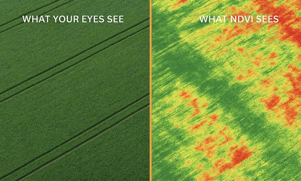
If you’re a farmer worried about wasted inputs, uneven growth, or hidden crop stress — NDVI scanning shows you what the eye can’t.
BOOK YOUR FREE SCAN
Our Services

Get a single NDVI drone scan with a detailed crop health report—perfect for a quick check-up or trial of our service.

Stay ahead of crop stress with a once-a-month NDVI scan and expert analysis to track changes and optimize decisions

Our most advanced option—twice-monthly NDVI scans with in-depth reports for real-time insights and maximum yield protection.

Our Mission
At AeroScout, we help Oregon farmers grow smarter with NDVI drone mapping that reveals crop stress before it costs you yield.
From the Willamette Valley to Marion County, our 48-hour crop health reports show where to act — and where to save on water, inputs, and time.
Whether you farm blueberries, hops, or row crops, our mission is simple:
Give you aerial insights that drive better decisions.
Contact Us
Interested in working together? Fill out some info and we will be in touch shortly. We can’t wait to hear from you!